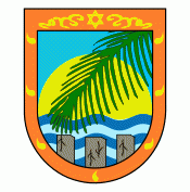
Sosúa
 |
The town is divided into three sectors: El Batey, which is the main tourist section and on the east side of the main beach (Playa Sosúa), Los Charamicos, on the west end of the beach and past that, heading north toward the airport, is Sosúa Abajo. Sosua is accessed primarily by Camino Cinco, or Highway 5, which runs the country's North coastline.
The town of Sosúa was officially founded by Jewish settlers (see Dominican Jews) who were fleeing from Nazi Germany. At the 1938 Evian Conference, Rafael Trujillo offered to accept up to 100,000 Jewish refugees; about 800 German and Austrian Jewish refugees received visas issued by the Dominican government between 1940 and 1945 and settled in Sosúa. An agreement was made between Trujillo and Jewish businessmen in New York City. The government provided the settlers with land and resources with which they created a food factory and company named Productos Sosúa still in existence today.
Descendants of the original Jewish settlers still live in Sosúa, among them is the former mayor Ilana Neumann. They remain an important segment of the community and maintain a synagogue and a museum.
Most of the descendants of the refugees have migrated to the United States. Some families remained and established inns and bed and breakfasts which were first visited by former refugees.
Map - Sosúa
Map


Country - Dominican_Republic
 |
 |
| Flag of the Dominican Republic | |
The native Taíno people had inhabited Hispaniola before the arrival of Europeans, dividing it into five chiefdoms. They had constructed an advanced farming and hunting society, and were in the process of becoming an organized civilization. The Taínos also inhabited Cuba, Jamaica, Puerto Rico, and the Bahamas. The Genoese mariner Christopher Columbus explored and claimed the island for Castile, landing there on his first voyage in 1492. The colony of Santo Domingo became the site of the first permanent European settlement in the Americas and the first seat of Spanish colonial rule in the New World. It would also become the site to introduce importations of enslaved Africans to the Americas. In 1697, Spain recognized French dominion over the western third of the island, which became the independent state of Haiti in 1804.
Currency / Language
| ISO | Currency | Symbol | Significant figures |
|---|---|---|---|
| DOP | Dominican peso | $ | 2 |
| ISO | Language |
|---|---|
| ES | Spanish language |